Location & Projects
 Building & Flat
 Back
BackProject Address
| City | Thane |
| Zone | Thane West |
| Locality | Owle Manpada Kolshet |
| Sub-Locality | Manorama Nagar |
| Pin Code | 400607 |
| Post Office | Chitalsar Manpada |
| Police Station | NA |
Administrative Coordinates
| State/UT | Maharashtra |
| District | Thane |
| Division | Konkan |
| Taluka | Thane |
| Village | Thane (m Corp.) |
| Street | Dhokali |
| Pin Code | 400607 |
| Locality Area | Thane West, 5990.00 |
Boundaries
| Boundaries - East Survey No -14 |
Boundaries - West Survey No -14 |
Boundaries - North Survey No -14 |
Boundaries - South Survey No -14 |
| Survey No / CTS No / Plot Bearing No / Final Plot No. New Survey No -13 And Old Survey No - 150 |
Map Address
6XPJ+FJX, Manorama Nagar, Thane West, Thane, Maharashtra

Brochure Address
6xpj+fjx, Manorama Nagar, Thane West, Thane, Maharashtra

Municipal Corporation / Council & Ward
Thane Municipal Corporation
NA

Physical Infrastructure
Medical Care
Highland Super Speciality Hospital
1.5 km
Educational Institutes
C.p. Goenka International School
2.7 km
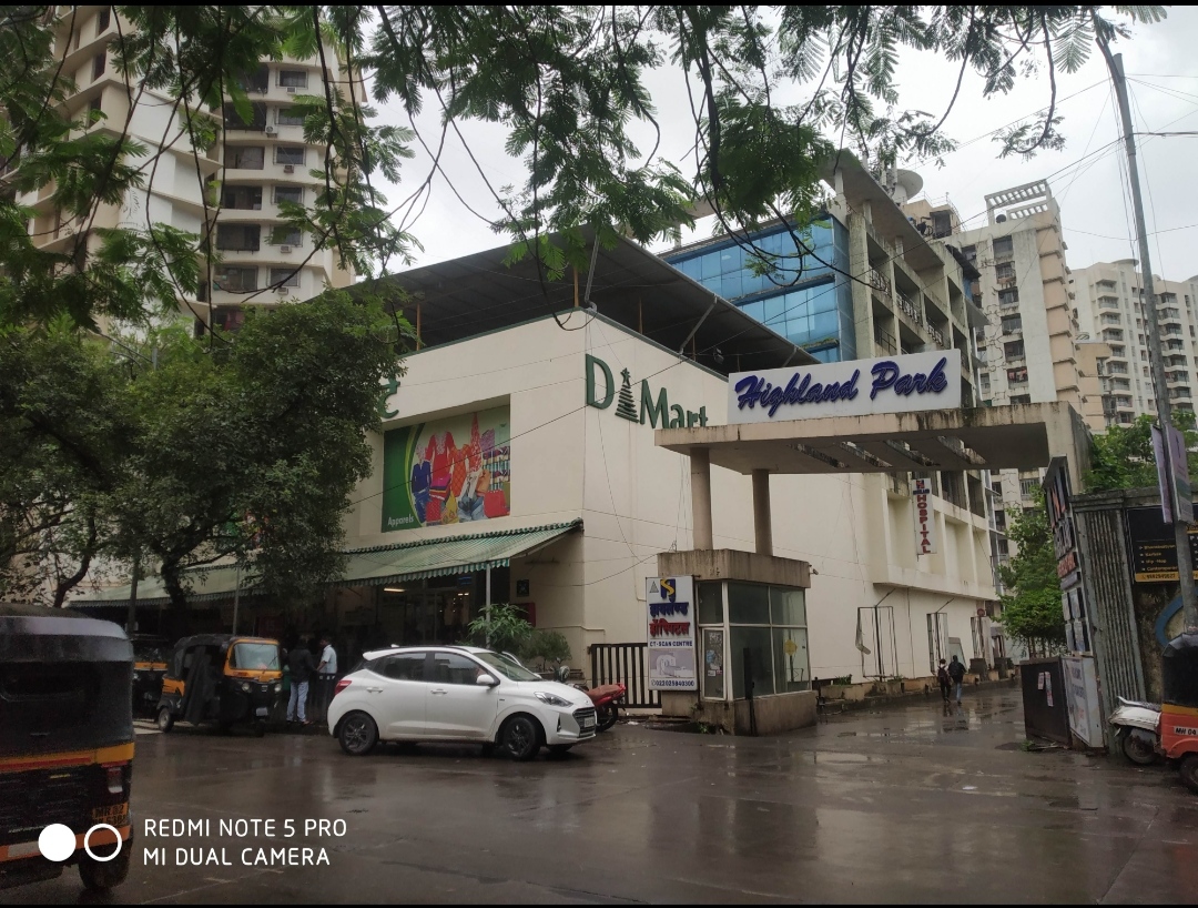
Retail & Supermarkets
Dmart Kolshet
1.5 km
International Airport
Chhatrapati Shivaji Maharaj International Airport
24.6 km
Bus Station
Manorama Nagar
350 m
Railway Station
Thane Railway Station
6.1 km
Highways & Roadways
Ghodbunder Rd
1.9 km
View More
View Less
Social Infrastructure
Malls & Entertainment
Viviana Mall
4.1 km
Commercial Infrastructure
Business Districts
| BKC | 26.6 km |
| Nariman Point / Fort | 41.1 km |
| Andheri East | 25.1 km |
| Thane | 2.1 km |
| Lower Parel | 33.9 km |
| Wagle Estate | 7.6 km |
 Locality & Neighbourhood
 Locality & Neighbourhood
|
|
Prone to traffic jams during rush hour
|
|
|
45
|
|
|
51 to 85 dB
|
|
|
There are slums settlements near the project
|
|
|
IOD (Intimidation of Disapproval) Certificate
|
Contact Details
| Organisation Name ( Builder's Name) | NA | Organisation Type | NA |
| Website URL | NA | Office Number | NA |
| Description Of Other Type Of Organisation | NA | ||
Address Details
| Block Number | NA | Building Name | NA |
| Street Name | NA | Locality | NA |
| Landmark | NA | Division | NA |
| Pin Code | NA | Taluka | NA |
| State /UT | NA | District | NA |
| Village | NA |
| Consultant Type | As per Brochure | As per RERA |
|---|