Location & Projects
 Building & Flat
 Back
BackProject Address
| City | Thane |
| Zone | Thane West |
| Locality | Owle Manpada Kolshet |
| Sub-Locality | Kasardavali |
| Pin Code | 400615 |
| Post Office | NA |
| Police Station | NA |
Administrative Coordinates
| State/UT | Maharashtra |
| District | Thane |
| Division | Konkan |
| Taluka | Thane |
| Village | Thane (m Corp.) |
| Street | NA |
| Pin Code | 400615 |
| Locality Area | NA, 2653.82 |
Boundaries
| Boundaries - East Survey No 21-11 A |
Boundaries - West Survey No 113-21 |
Boundaries - North Survey No21-8a And 113-21 |
Boundaries - South Survey No 21-12 21-13 And 21-14 |
| Survey No / CTS No / Plot Bearing No / Final Plot No. 21/11b Pt |
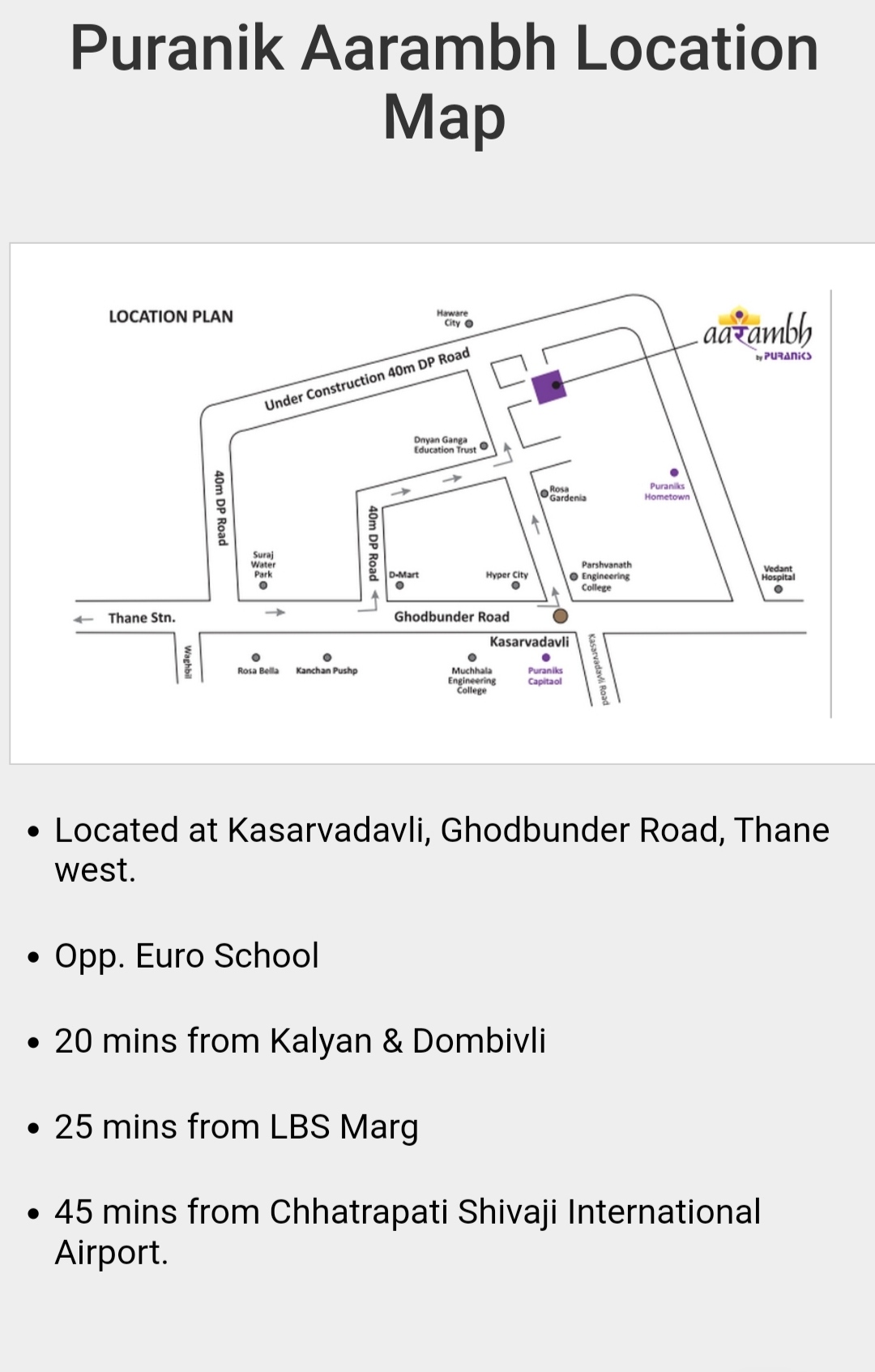
Map Address
Puranik Aarambh, Ghodbunder Rd, Kasarvadavali, Thane West, Thane, Maharashtra 400615

Brochure Address
Puranik Aarambh, Ghodbunder Rd, Kasarvadavali, Thane West, Thane, Maharashtra 400615

Municipal Corporation / Council & Ward
Thane Municipal Corporation
NA

Physical Infrastructure
Medical Care
Vedant Hospital, Owale
2.7 km
Educational Institutes
New Horizon Scholar's School, Anand Nagar,
2.5 km
Retail & Supermarkets
D Mart Kavesar
1.9 km
International Airport
Chhatrapati Shivaji Maharaj International Airport
29.6 km
Bus Station
Railway Station
Thane Railway Station
10.7 km
Highways & Roadways
View More
View Less
Social Infrastructure
Malls & Entertainment
Big Mall
1.8 km
Commercial Infrastructure
Business Districts
| BKC | 32.1 km |
| Nariman Point / Fort | 49.2 km |
| Andheri East | 29.6 km |
| Thane | 6.7 km |
| Lower Parel | 39.4 km |
| Wagle Estate | 12.8 km |
 Locality & Neighbourhood
 Locality & Neighbourhood
|
|
-
|
|
|
-
|
|
|
-
|
|
|
-
|
|
|
-
|
Contact Details
| Organisation Name ( Builder's Name) | NA | Organisation Type | NA |
| Website URL | NA | Office Number | NA |
| Description Of Other Type Of Organisation | NA | ||
Address Details
| Block Number | NA | Building Name | NA |
| Street Name | NA | Locality | NA |
| Landmark | NA | Division | NA |
| Pin Code | NA | Taluka | NA |
| State /UT | NA | District | NA |
| Village | NA |
| Consultant Type | As per Brochure | As per RERA |
|---|