Location & Projects
 Building & Flat
 Back
BackProject Address
| City | Mumbai City |
| Zone | Eastern Suburbs |
| Locality | Mulund (east) |
| Sub-Locality | Navghar |
| Pin Code | 400081 |
| Post Office | Mhada Colony |
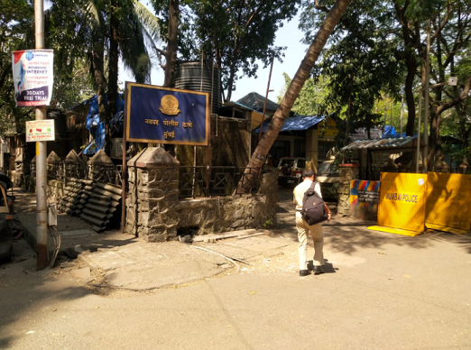
| Police Station | Navghar Police Station |
Administrative Coordinates
| State/UT | Maharashtra |
| District | Mumbai Suburban |
| Division | Konkan |
| Taluka | Kurla |
| Village | Kurla |
| Street | Navghar Road, |
| Pin Code | 400081 |
| Locality Area | Mulund East, Opp Navghar Police Station, Mhada Colony, Mulund East,, 35121.78 |
Boundaries
| Boundaries - East Nalla |
Boundaries - West Club House And Podium |
Boundaries - North Nalla |
Boundaries - South Dp Road |
| Survey No / CTS No / Plot Bearing No / Final Plot No. Cts No.1320a Pt1320a211 To 4, 1320 A 22 To 33 |
Map Address
Mhada, New PMGP Co-Operative Housing Society Ltd Navghar Road, Mulund East, Opp Navghar Police Station, Mumbai, Maharashtra 400081

Brochure Address
Tata Housing Aveza Mhada, New Pmgp Co-operative Housing Society Ltd Navghar Road, Mulund East, Opp Navghar Police Station, Mumbai, Maharashtra 400081

Municipal Corporation / Council & Ward
Municipal Corporation Of Greater Mumbai
Ward T

Physical Infrastructure
Medical Care
Fortis Hospital Mulund
4.1 km
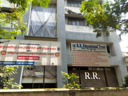
Educational Institutes
Bombay Presidency International School
1.7 km
Retail & Supermarkets
Mamta Super Market
550 m
International Airport
Chhatrapati Shivaji Maharaj International Airport
16 km
Bus Station
Mulund Toll Naka Bus Stop
260 m
Railway Station
Mulund Railway Station (e)
1.6 km
Highways & Roadways
Eastern Express Hwy, Maharashtra
600 m
View More
View Less
Social Infrastructure
Malls & Entertainment
R Mall
3.6 km
Commercial Infrastructure
Business Districts
| BKC | 18 km |
| Nariman Point / Fort | 33.9 km |
| Andheri East | 17.4 km |
| Thane | 7.3 km |
| Lower Parel | 25.8 km |
| Airoli Mindspace | 9.3 km |
 Locality & Neighbourhood
 Locality & Neighbourhood
 Locality & Neighbourhood
 Locality & Neighbourhood
|
|
Prone to traffic jams during rush hour
|
|
|
102
|
|
|
0 to 50 dB
|
|
|
There are slums settlements near the project
|
|
|
-
|
Contact Details
| Organisation Name ( Builder's Name) | NA | Organisation Type | NA |
| Website URL | NA | Office Number | NA |
| Description Of Other Type Of Organisation | NA | ||
Address Details
| Block Number | NA | Building Name | NA |
| Street Name | NA | Locality | NA |
| Landmark | NA | Division | NA |
| Pin Code | NA | Taluka | NA |
| State /UT | NA | District | NA |
| Village | NA |
| Consultant Type | As per Brochure | As per RERA |
|---|