Location & Projects
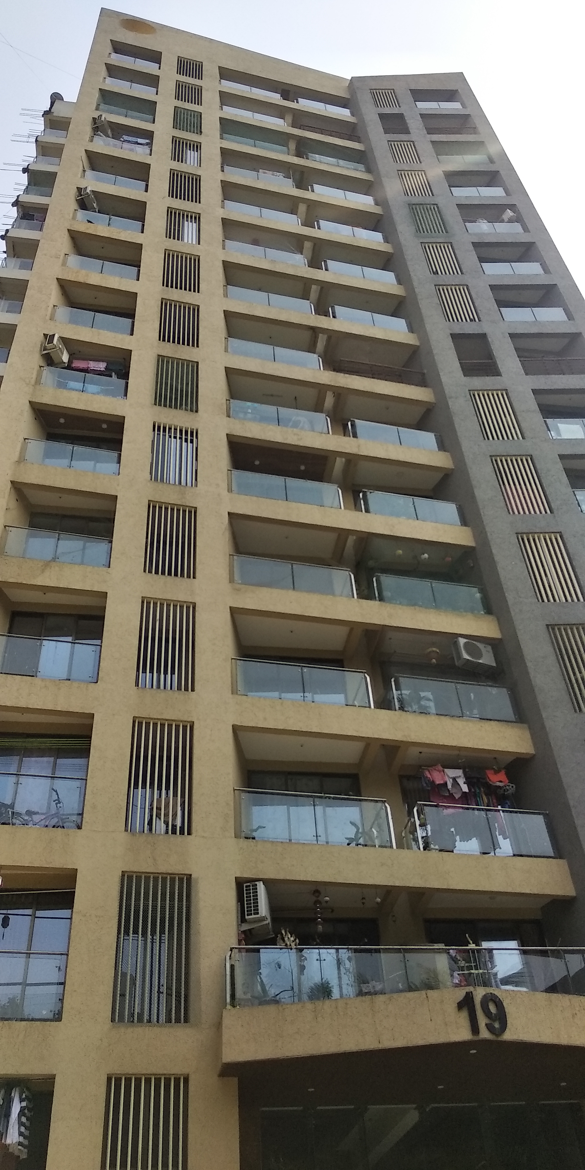
 Building & Flat
 Back
BackProject Address
| City | Mira-bhayandar |
| Zone | Mira Road |
| Locality | Mira Road East |
| Sub-Locality | Kashimira |
| Pin Code | 401107 |
| Post Office | Mira Road |
| Police Station | Kanikya |
Administrative Coordinates
| State/UT | Maharashtra |
| District | Thane |
| Division | Konkan |
| Taluka | Thane |
| Village | Mira-bhayandar (m Corp.) |
| Street | NA |
| Pin Code | 401107 |
| Locality Area | NA, 5483.21 |
Boundaries
| Boundaries - East 182 6 |
Boundaries - West 182 5 |
Boundaries - North 182 8 |
Boundaries - South 182 3 |
| Survey No / CTS No / Plot Bearing No / Final Plot No. 181 7a 7b 9 10 182 3 4 5 6 8 |
Map Address
Shree Shashwat Building No 20, Shree Shashwat Rd, Pleasant Park, Mira Road, Mira Bhayandar, Maharashtra 401107

Brochure Address
Shree Shashwat Building No 20, Shree Shashwat Rd, Pleasant Park, Mira Road, Mira Bhayandar, Maharashtra 401107

Municipal Corporation / Council & Ward
Mira -bhayandar Municipal Corporation
NA

Physical Infrastructure
Medical Care
Family Care Hospital
3.2 km
Educational Institutes
Seven Square Academy
3.2 km
Retail & Supermarkets
D Mart
4.4 km
International Airport
Mumbai International Airport
24.6 km
Bus Station
Kashimira Bus Station
1.7 km
Railway Station
Mira Road Railway Station
2.8 km
Highways & Roadways
Western Express Highway
2.2 km
View More
View Less
Social Infrastructure
Malls & Entertainment
Maxus Mall
4.4 km
Commercial Infrastructure
Business Districts
| BKC | 29.0 km |
| Nariman Point / Fort | 44.8 km |
| Andheri East | 21.1 km |
| Thane | 20.0 km |
| Lower Parel | 35.8 km |
| Mindspace, Malad | 15.1 km |
 Locality & Neighbourhood
|
|
-
|
|
|
-
|
|
|
-
|
|
|
-
|
|
|
-
|
Contact Details
| Organisation Name ( Builder's Name) | NA | Organisation Type | NA |
| Website URL | NA | Office Number | NA |
| Description Of Other Type Of Organisation | NA | ||
Address Details
| Block Number | NA | Building Name | NA |
| Street Name | NA | Locality | NA |
| Landmark | NA | Division | NA |
| Pin Code | NA | Taluka | NA |
| State /UT | NA | District | NA |
| Village | NA |
| Consultant Type | As per Brochure | As per RERA |
|---|